

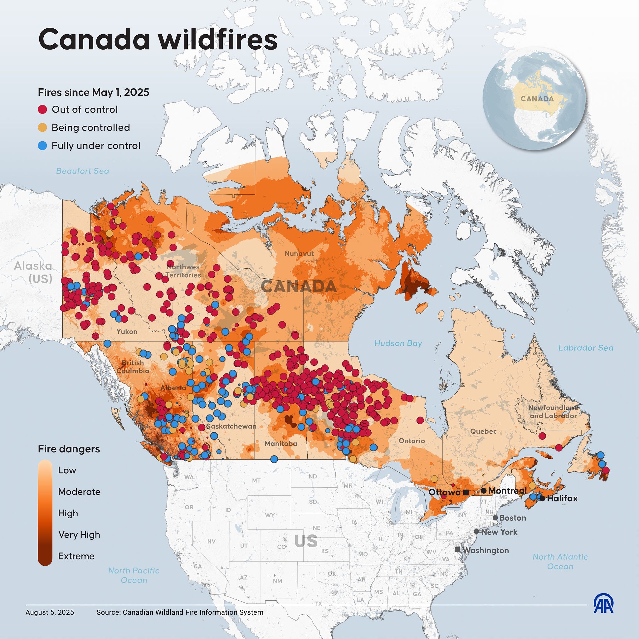
The transboundary reality of wildfire smoke. Source: Anadolu / Anadolu via Getty Images
Once again, millions of people across the US Midwest and Northeast are waking up to a dull orange sun and a throat-scratching haze. The latest Canadian forest fires have sent massive plumes of particulate matter traveling thousands of miles, triggering air quality alerts and forcing families indoors.
It is a stark visual reminder: Wildfires don’t respect borders, and suppression alone is no longer enough.
To truly protect our air quality and communities, we have to look upstream at how we manage our forests. The most effective tool we have to mitigate these catastrophic fires is also the one that requires the most precise weather data: controlled (or prescribed) burns.
The Catch-22 of Fire Mitigation
For centuries, indigenous communities and forestry experts have known that “good fire” prevents “bad fire”. By deliberately burning off accumulated forest litter, dry underbrush, and invasive species during mild weather, we starve potential wildfires of their fuel.
But executing a controlled burn is an incredibly tense tightrope walk.
- Too cold or wet? The fuel won’t burn, and the effort is wasted.
- Too hot, dry, or windy? A controlled burn can escape its boundaries, turning a preventative measure into a localized disaster.
Historically, land managers have relied on regional weather forecasts. However, a regional forecast only tells you the average weather across a massive 10-to-20-mile grid. In rugged forest terrain, a valley can be damp and windless while a ridge just half a mile away is bone-dry and experiencing high gusts.
Moving From Regional Guesses to Hyperlocal Certainty
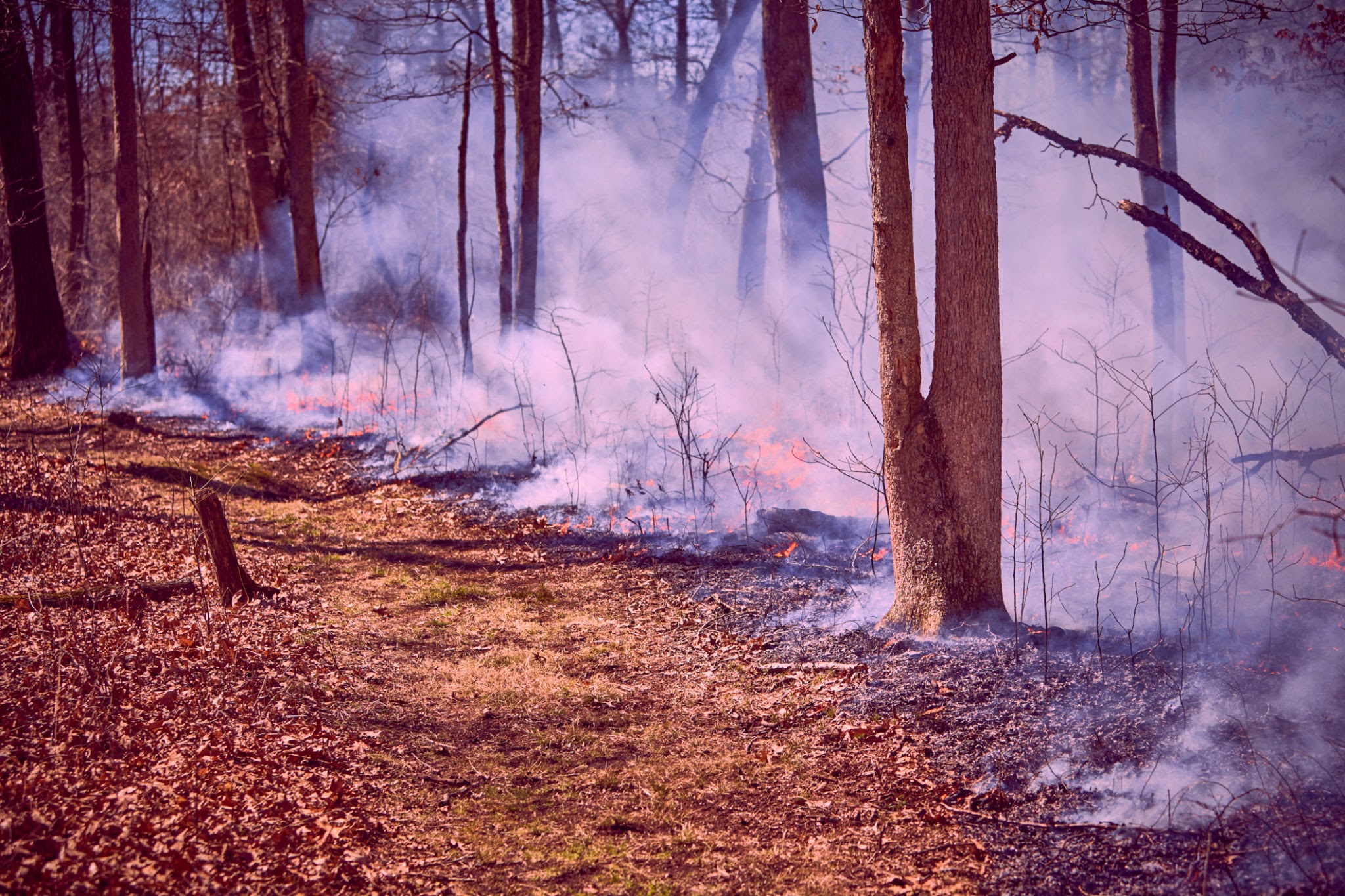
Controlled burns require exact environmental conditions to remain safe. Source: quadxeon / Getty Images
This microclimate gap is where artificial intelligence and local IoT sensors are rewriting the script. At Benchmark Labs, we developed Burncast—a specialized fire weather visualization and forecasting tool—specifically to help land managers find their perfect operational windows with absolute confidence.
Instead of relying on distant, generalized airport weather stations, our platform combines physical, on-site sensors with advanced machine learning. This delivers point-specific (latitude, longitude, and exact elevation) 15-day hourly forecasts of the exact variables that dictate fire behavior: relative humidity, wind speed, wind direction, and temperature.
How Technology Safeguards Prescribed Burns
Here is how modern forestry teams use hyperlocal AI forecasting to safely plan and execute a burn, keeping smoke levels manageable and communities safe:
1.Assess the Fuel Load: Weeks in Advance.
Land managers map the density and dryness of the forest undergrowth. Benchmark Labs’ historical data APIs help contextually compare current fuel moisture levels against historical averages to gauge risk.
2.Monitor the Microclimate:10 to 15 Days Out.
Teams use Burncast to monitor upcoming weather trends. Instead of guessing based on a regional average, they track point-specific wind vectors and humidity levels at the exact ridges and valleys slated for the burn.
3.Identify the Safe Burn Window: 3 to 5 Days Out.
Using hyperlocal AI-driven forecasts, managers pinpoint the exact hours where wind direction will carry smoke away from nearby communities and highways, and where relative humidity will remain high enough to keep the fire slow and manageable.
4.Execute with Real-Time Alerts: Day of Burn.
With IoT-connected weather stations and point-specific alerts, on-site teams receive immediate warnings if localized wind patterns or temperatures deviate from the forecast, allowing them to adjust boundaries or suppress the burn safely before issues arise.
A Healthier Future, One Burn at a Time
We can’t stop lightning from striking, and we can’t eliminate all forest fires. But by using tools like Burncast to significantly lower the risks of controlled burns, we can empower land managers to scale up preventative treatments.
More safely executed controlled burns mean less raw, dry fuel in our forests. And ultimately, that means fewer catastrophic wildfires, fewer orange skies, and cleaner, safer air for all of us.
Are you a land manager, conservationist, or utility provider looking to mitigate wildfire risk? Contact Benchmark Labs today to learn how Burncast can bring point-specific precision to your operations.